Ulteriori informazioni
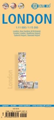
Unsere folienbeschichtete und gefaltete Borch Map von London in der 22. Auflage beinhaltet: London 1:15 000, Kew Gardens & Richmond 1:35 000, das Zentrum 1:11 000, den Großraum London 1:375 000, die Flughäfen Heathrow, Gatwick und Stansted, das öffentliche Verkehrsnetz und eine administrative Übersichtskarte von Großbritannien. Borch Maps beinhalten eine Vielzahl interessanter und nützlicher Informationen wie Top Sights, Museen, Monumente, Märkte und viele weitere Sehenswürdigkeiten, aber auch Statistiken, Umrechnungstabellen, Klimadiagramme und viele detailreiche Übersichtskarten, die eine Borch Map zu einem exzellenten Reisebegleiter machen. Kartenformat (offen): 990 x 494 mm.
Sommario
Aus dem Inhalt:
London 1:15 000, Kew Gardens and Richmond 1:35 000, Central Sights 1:11 000, Greater London 1:375 000, Heathrow Airport, Stansted Airport und Gatwick Airport, eine politische Karte von Großbritannien; interessante Statistiken, eineUmrechnungstabelle für Temperaturen, Gewichts- und Maßeinheiten, eine Klimatabelle mit Temperaturen, Sonnenstunden, Niederschlag und Luftfeuchtigkeit, listet Sehenswürdigkeiten, Hotels, Museen, Märkte, ÖPNV
Info autore
Die Borch GmbH produziert seit 20 Jahre die Borch Map Kartenserie und vetreibt diese weltweit. Mit nahezu 100 Titeln, ist die Borch Themenpalette breit aufgestellt, kommende Neuentwicklungen bringen eine neue Lebendigkeit und eine inhaltlich unvergleichbare Vielfalt mit sich und die doppelseitige Cellophanierung aller Borch Maps sorgt für ein wertiges und robustes Produkterlebnis.
Riassunto
Our laminated and folded Borch Map of London in the 22nd edition contains: London 1:15 000, Kew Gardens & Richmond 1:35 000, Central Sights 1:11 000, Greater London 1:375 000, Airports Heathrow, Gatwick, Stansted, the public transport system and an administrative map of Great Britain. Borch Maps contain a multitude of interesting and useful information like Top Sights, museums, monuments, markets and many other attractions, but also statistics, conversion tables, climate data and many detail maps, making a Borch Map an excellent travel companion. Map format (open): 990 x 494 mm.