Fr. 59.90

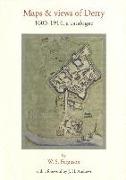
Maps and Views of Derry, 1600-1914: A Catalogue

Inglese · Tascabile

Spedizione di solito min. 4 settimane (il titolo viene procurato in modo speciale)

Descrizione

Ulteriori informazioni


As part of a number of ancillary publications to the Irish Historic Towns Atlas, and written by W.S. Ferguson in the 1960s and 1970s, this book brings together a comprehensive catalogue of maps and views of Derry and its environs. The book includes the Phillips map from 1689, which is reproduced in full. This resource is a joint publication between the Royal Irish Academy and Derry City Council, and is part of a project to record the topographical development of a selection of Irish towns both large and small.


Dettagli sul prodotto

Autori J. H. Andrews, W. S. Ferguson
Editore Royal Irish Academy
 
Lingue Inglese
Formato Tascabile
Pubblicazione 01.01.2005
 
EAN 9781904890072
ISBN 978-1-904890-07-2
Pagine 108
Serie Irish Historic Towns Atlas
Categoria Scienze umane, arte, musica > Storia

Recensioni dei clienti

Per questo articolo non c'è ancora nessuna recensione. Scrivi la prima recensione e aiuta gli altri utenti a scegliere.

Scrivi una recensione

Top o flop? Scrivi la tua recensione.

Per i messaggi a CeDe.ch si prega di utilizzare il modulo di contatto.

I campi contrassegnati da * sono obbligatori.

Inviando questo modulo si accetta la nostra dichiarazione protezione dati.