Condividi
Keith Carter, Keith Stedman Carter, Henry Stedman
OFFA'S DYKE PATH
Inglese ·
Descrizione
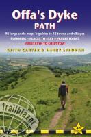
A practical route guide to walking the whole path following Offa's Dyke. Includes 98 large-scale maps; full details of all accommodations, restaurants, pubs, public transport information, places to eat, places to see. GPS waypoints.
Sommario
INTRODUCTION - (1) PART 1: PLANNING YOUR WALK 1.1 About the Offa's Dyke Path, History - How difficult is the Offa's Dyke Path? (route finding) - How long do you need? 1.2 Practical information for the walker Accommodation (camping, bunkhouses and hostels, bed and breakfast) - Food and drink (drinking water, buying camping supplies, pubs) (Aside: Beer) - Money - Other services - Walking companies (accommodation booking, baggage carriers, self-guided holidays, group/guided walking tours) 1.3 Budgeting Camping - Bunkhouses and hostels - B&Bs - Extras (Aside: Information for foreign visitors) 1.4 When to go Seasons (spring, summer, autumn, winter) - Temperature - Rainfall - Daylight hours 1.5 Itineraries and Planning map - Which direction? - Village and town facilities - Suggested itineraries (Asides: Highlights of the Offa's Dyke Path - the best day and weekend walks; Walking with dogs) 1.6 What to take Keep it light - How to carry it - Footwear (boots, socks, extra footwear) - Clothes (Aside: Cheaper alternatives) - Toiletries - First aid kit - General items - Sleeping bag - Camping gear - Travel insurance - Maps - Recommended reading (general guidebooks, flora and fauna field guides) 1.7 Getting to and from the Offa's Dyke Path (Aside: Getting to Britain) National transport (rail, coach, car, air) - Local transport - Public transport map 1.8 Further information Trail information - National Parks - Tourist information - Organizations for walkers (2) PART 2: MINIMUM IMPACT WALKING AND OUTDOOR SAFETY 2.1 Economic impact Buy local (Aside: Food for thought) - Support local businesses - Encourage local cultural traditions and skills (Aside: The state of the farmed countryside) 2.2 Environmental impact Use public transport whenever possible --Never leave litter (Aside- The lasting impact of litter) - Erosion - Respect all wildlife - Outdoor toiletry - Wild camping (Aside - Your ecological footprint) 2.3 Access Right to roam - Rights of way (Aside: National Parks and the honey pot issue) - Waymarking - The Country Code - Lambing 2.4 Outdoor safety - Avoidance of hazards - Mountain safety - Weather forecasts - Water - Biting insects - Hypothermia - Dealing with an accident (3) PART 3: THE ENVIRONMENT AND NATURE 3.1 Conserving the Anglo-Welsh border country: Countryside Council for Wales, Voluntary organizations, Beyond conservation 3.2 History - Offa and the construction of the Dyke 3.3 Flora and fauna Mammals - Reptiles - Birds - Wild flowers, grasses and other plants - Trees, woods and forests (4) PART 4: ROUTE GUIDE AND MAPS 4.1 Trail maps Scale and walking times - Up or down? - Accommodation - Other features 4.2 THE OFFA'S DYKE PATH Prestatyn - Prestatyn to Rhuallt - Rhuallt - Rhuallt to Bodfari - Sodom - Bodfari to Clwyd Gate (A494) - Clwyd Gate to Llandegla - Llanarmon-yn-lal - Llandegla - Llandegla to Llangollen - Llangollen - Llangollen to Castle Mill - Trevor and Garth - Froncysyllte - Castle Mill and Bronygarth - Castle Mill to Racecourse Common - Racecourse Common to Llanymynech - Llanymynech - Llanymynech to Buttington - Four Crosses - Pool Quay - Buttington - Welshpool - Buttington to Brompton Crossroads - Leighton - Kingswood - Forden - Montgomery - Brompton Crossroads - Brompton Crossroads to Knighton - Bishop's Castle - Newcastle-on-Clun - Clun - Knighton - Knighton to Kington - Dolley Green - Presteigne - Kington - to Hay-on-Wye - Gladestry - Newchurch - Hay-on-Wye - Hay-on-Wye to Pandy - Capel-y-ffin - Llanthony - Longtown - Pandy - Pandy to Llantilio-Crossenny - Llangattock-Lingoed - Caggle Street and Llanvetherine - Llantilio-Crossenny - Llantilio-Crossenny to Monmouth - Monmouth - Monmouth to Chepstow - Redbrook - St Briavels - Brockweir - Tintern - Chepstow - Chepstow to Sedbury Cliffs (5) APPENDICES 5.1 A: Health and outdoor safety 5.2 B: Glossary of Welsh words 5.3 C: Trail map key (6) COLOUR STAGE MAPPING AND TRAIL PROFILES
Info autore
Keith Carter has over 40 years' experience of hiking Britain's long-distance paths with numerous magazine articles published on the subject. He is also co-author of Trailblazer's Pennine Way (British Walking Guide in the same series). Henry Stedman has updated this 4th edition. He has written or co-written over 10 Trailblazer titles, including: Coast to Coast Path, Hadrian's Wall Path, South West Coast Path Parts 1-3, Kilimanjaro - the trekking guide to Africa's highest mountain.
Riassunto
Hiking route guide to 177-mile path following Offa's Dyke, the 8th century earthwork along the Wales/England border. 98 large-scale maps; full details of all accommodations, restaurants, pubs.
Dettagli sul prodotto
| Autori | Keith Carter, Keith Stedman Carter, Henry Stedman |
| Editore | Trailblazer |
| Lingue | Inglese |
| Pubblicazione | 25.03.2015 |
| EAN | 9781905864652 |
| ISBN | 978-1-905864-65-2 |
| Pagine | 252 |
| Dimensioni | 120 mm x 180 mm x 20 mm |
| Peso | 253 g |
| Serie |
Walking Guide British Walking Guides British Walking Guides (Trailblazer) British Walking Guides (Trailblazer) British Walking Guides |
| Categoria |
Viaggi
> Guide turistiche
|
Recensioni dei clienti
Per questo articolo non c'è ancora nessuna recensione. Scrivi la prima recensione e aiuta gli altri utenti a scegliere.
Scrivi una recensione
Top o flop? Scrivi la tua recensione.

