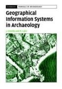
Descrizione
Dettagli sul prodotto
| Autori | James Conolly, James (Trent University Conolly, James Lake Conolly, Mark Lake, Mark (University College London) Lake |
| Editore | Cambridge University Press ELT |
| Lingue | Inglese |
| Formato | Copertina rigida |
| Pubblicazione | 04.05.2006 |
| EAN | 9780521793308 |
| ISBN | 978-0-521-79330-8 |
| Pagine | 358 |
| Serie |
Cambridge Manuals in Archaeology Cambridge Manuals in Archaeology |
| Categorie |
Saggistica
> Storia
> Preistoria e protostoria, mondo antico
Scienze umane, arte, musica > Storia > Preistoria e protostoria |
Recensioni dei clienti
Per questo articolo non c'è ancora nessuna recensione. Scrivi la prima recensione e aiuta gli altri utenti a scegliere.
Scrivi una recensione
Top o flop? Scrivi la tua recensione.

