Ulteriori informazioni
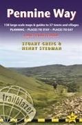
Informationen zum Autor Keith Carter has over 40 years' experience of hiking Britain's long-distance paths with numerous magazine articles published on the subject. He has also written for Trailblazer's British Walking Guides series: Offa's Dyke Path. Klappentext Walking guide to the 256-mile Pennine Way, Britain's best-known National Trail. 138 large-scale maps (just under 1:20,000); full details of all accommodations, restaurants, pubs. Zusammenfassung Hiking route guide to the 256-mile Pennine Way, Britain's best-known National Trail. 138 large-scale maps (3 1/8 inches to 1 mile); full details of all accommodations, restaurants, pubs. Inhaltsverzeichnis INTRODUCTION - PART 1: PLANNING YOUR WALK 1.1 About the Pennine Way, History - How difficult is the Pennine Way? (route finding) - How long do you need? 1.2 Practical information for the walker Accommodation (camping, bunkhouses and hostels, bed and breakfast) - Food and drink (drinking water, buying camping supplies, pubs) (Aside: Beer) - Money - Other services - Walking companies (accommodation booking, baggage carriers, self-guided holidays, group/guided walking tours) 1.3 Budgeting Camping - Bunkhouses and hostels - B;Bs - Extras (Aside: Information for foreign visitors) 1.4 When to go Seasons (spring, summer, autumn, winter) - Temperature - Rainfall - Daylight hours 1.5 Itineraries and Planning map - Which direction? - Village and town facilities - Suggested itineraries (Asides: Highlights of the Pennine Way - the best day and weekend walks; Walking with dogs) 1.6 What to take Keep it light - How to carry it - Footwear (boots, socks, extra footwear) - Clothes (Aside: Cheaper alternatives) - Toiletries - First aid kit (Aside - Mountain rescue) - General items - Sleeping bag - Camping gear - Travel insurance - Maps - Recommended reading (general guidebooks, flora and fauna field guides) 1.7 Getting to and from the Pennine Way (Aside: Getting to Britain) National transport (rail, coach, car, air) - Local transport - Public transport map 1.8 Further information Trail information - National Parks - Tourist information - Organisations for walkers PART 2: THE NATURE OF THE PENNINE WAY 2.1 Flora and fauna Mammals - Reptiles - Birds (streams, rivers and lakes; woodland; moor, bog and grazing; buildings and cliffs) - Wild flowers, grasses and other plants (Aside: How do you identify a flower?) (bogs and wet areas; woodlands; higher areas; lower areas) (Asides: Why are flowers the colour they are; Orchids; Wild flowers) - Trees, woods and forests (oak and broadleaf woodlands; coniferous woodland (Aside: The Forestry Commission) 2.2 Conserving the nature of the Pennines Government agencies and schemes - Voluntary organisations - Beyond conservation PART 3: MINIMUM IMPACT WALKING 3.1 Economic impact Buy local (Aside: Food for thought) - Support local businesses - Encourage local cultural traditions and skills (Aside: The state of the farmed countryside) 3.2 Environmental impact Use public transport whenever possible --Never leave litter (Aside- The lasting impact of litter) - Erosion - Respect all wildlife - Outdoor toiletry - Wild camping (Aside - Your ecological footprint) 3.3 Access Right to roam - Rights of way (Aside: National Parks and the honey pot issue) - Waymarking - The Country Code - Lambing - Grouse shooting PART 4: THE PENNINE WAY - EDALE TO KIRK YETHOLM Trail maps Scale and walking times - Up or down? - Accommodation - Other features Edale to Crowden (Asides: Kinder Scout; Trans-Pennine Trail) Crowden to Standedge Standedge to the Calder Valley (for Hebden Bridge)(Aside: Stoodley Pike) Calder Valley to Ponden (Aside: The Brontes of Haworth) Ponden to Thornton-in-Craven Thornton-in-Craven to Malham, Malham to Horton-in-Ribblesdale (Asides: Fountains Fell; Fell running) Horton-in-Ribblesdale to Hawes (Aside: Packhorse roads) Hawes to Keld(Aside: Field Barns) Keld to Tan...