Fr. 55.50

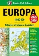
Europa. Atlante stradale e turistico 1:800.000. 2025-2026

English, French, German, Italian, Spanish · Paperback / Softback

Shipping usually takes at least 4 weeks (title will be specially ordered)

Description

Read more


L'Atlante stradale d'Europa, in un volume compatto e dal pratico formato, rappresenta tutta la rete stradale europea in scala 1:800 000 (Europa del nord in scala 1:2 500 000), e comprende tutti i Paesi dell'Unione Europea (escluso Cipro). 344 pagine di cartografia stradale e turistica ideale per i grandi itinerari e le informazioni essenziali per viaggiare. Legenda in 5 lingue anche per il turista straniero: italiano, inglese, tedesco, francese e spagnolo; 344 pagine di cartografia stradale e turistica alle scale 1:800 000 e 1:2 500 000; 2 Carte tematiche: Divisione politica dell'Europa e Unione Europea 2 tabelle con informazioni per viaggiare; Indice con oltre 76 000 toponimi; Tabella delle distanze stradali chilometriche tra le principali località. Das Urheberrecht an bibliographischen und produktbeschreibenden Daten und an den bereitgestellten Bildern liegt bei Informazioni Editoriali, I.E. S.r.l., oder beim Herausgeber oder demjenigen, der die Genehmigung erteilt hat. Alle Rechte vorbehalten.

Product details

Publisher Touring
 
Languages English, French, German, Italian, Spanish
Product format Paperback / Softback
Released 28.02.2025
 
EAN 9788836583157
ISBN 978-88-365-8315-7
No. of pages 361
Dimensions 184 mm x 164 mm x 25 mm
Weight 1070 g
Series Touring
Atlanti stradali
Subject Travel > Maps, city plans, atlases

Customer reviews

No reviews have been written for this item yet. Write the first review and be helpful to other users when they decide on a purchase.

Write a review

Thumbs up or thumbs down? Write your own review.

For messages to CeDe.ch please use the contact form.

The input fields marked * are obligatory

By submitting this form you agree to our data privacy statement.