Fr. 47.50

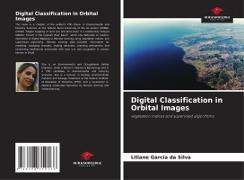
Digital Classification in Orbital Images - vegetation indices and supervised algorithms

English · Paperback / Softback

Shipping usually within 2 to 3 weeks (title will be printed to order)

Description

Read more

This book is a chapter of the author's PhD thesis in Environmental and Forestry Sciences at the Federal Rural University of Rio de Janeiro (UFRRJ), entitled "Digital mapping of land use and land cover in a biodiversity hotspot (Atlantic Forest) in the Capivari River basin", which she dedicates to readers interested in Digital Mapping in Remote Sensing using vegetation indices and supervised algorithms. Remote sensing data provides information for modeling, analyzing changes, making decisions, planning phenomena and conserving biodiversity associated with land use and occupation in various biomes in Brazil.

About the author


Jest in¿ynierem ¿rodowiska i bezpiecze¿stwa pracy, posiada tytü magistra w dziedzinie agroenergetyki i jest doktorantk¿ w dziedzinie nauk o ¿rodowisku i le¿nictwie. Jest wyk¿adowc¿ ekologii, zanieczyszczenia ¿rodowiska i oczyszczania ¿cieków w Federalnym Instytucie Edukacji Tocantins (IFTO) oraz badaczem w zakresie mapowania dynamiki krajobrazu za pomoc¿ teledetekcji i geoprzetwarzania.

Product details

Authors Liliane Garcia da Silva
Publisher Our Knowledge Publishing
 
Languages English
Product format Paperback / Softback
Released 10.03.2025
 
EAN 9786208719166
ISBN 9786208719166
No. of pages 52
Subject Natural sciences, medicine, IT, technology > Geosciences > Miscellaneous

Customer reviews

No reviews have been written for this item yet. Write the first review and be helpful to other users when they decide on a purchase.

Write a review

Thumbs up or thumbs down? Write your own review.

For messages to CeDe.ch please use the contact form.

The input fields marked * are obligatory

By submitting this form you agree to our data privacy statement.