Fr. 33.50

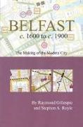
Belfast C. 1600 to C. 1900

English · Paperback / Softback

Shipping usually takes at least 4 weeks (title will be specially ordered)

Description

Read more


This folded pocket map of modern Belfast is overlaid with color and symbols illustrating the city's history from c.1600 to c.1900. With an introductory essay and over 200 features mapped and indexed, this covered map is an ideal aid for a walking tour of historical Belfast. The map is an ancillary publication to the Irish Historic Towns Atlas series, with Raymond Gillespie and Stephen A. Royle being joint authors of Irish Historic Towns Atlas, No. 12, Belfast, Part I, to 1840 ISBN 978 0 9543855 0 7 $32.00 (2003)


Product details

Authors Raymond Gillespie, Stephen A. Royle
Publisher Royal Irish Academy
 
Languages English
Product format Paperback / Softback
Released 01.01.2007
 
EAN 9781904890201
ISBN 978-1-904890-20-1
No. of pages 19
Series Irish Historic Towns Atlas
Subject Humanities, art, music > History

Customer reviews

No reviews have been written for this item yet. Write the first review and be helpful to other users when they decide on a purchase.

Write a review

Thumbs up or thumbs down? Write your own review.

For messages to CeDe.ch please use the contact form.

The input fields marked * are obligatory

By submitting this form you agree to our data privacy statement.