Fr. 74.00

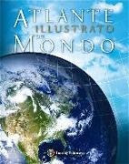
Atlante illustrato del mondo

Italian · Hardback

Shipping usually takes at least 4 weeks (title will be specially ordered)

Description

Read more


Un Atlante geografico illustrato completamente nuovo, che comprende in un solo volume tavole cartografiche, immagini satellitari, illustrazioni, fotografie e grafici. Redatto con la supervisione di un comitato scientifico, costituito da eccellenti cartografi ed esperti nelle varie discipline, questo Atlante include più di 330 mappe, 46 carte regionali, 4 mappe oceaniche e 18 carte tematiche il tutto accompagnato da testi concisi ma di denso contenuto. Immagini da satellite e informazioni riguardanti popolazione, suolo e impatto umano sull'ambiente completano le informazioni per ogni continente.

Product details

Assisted by M. Zanoni (Illustration)
Publisher Touring
 
Languages Italian
Product format Hardback
Released 05.09.2012
 
EAN 9788836561780
ISBN 978-88-365-6178-0
No. of pages 304
Dimensions 276 mm x 346 mm x 30 mm
Weight 2278 g
Series Atlanti geografici e tematici
TOURING
Touring
Atlanti geografici e tematici
Subjects Non-fiction book > Dictionaries, reference works > Dictionaries, encyclopaedias
Travel > Maps, city plans, atlases

Customer reviews

No reviews have been written for this item yet. Write the first review and be helpful to other users when they decide on a purchase.

Write a review

Thumbs up or thumbs down? Write your own review.

For messages to CeDe.ch please use the contact form.

The input fields marked * are obligatory

By submitting this form you agree to our data privacy statement.