Fr. 18.50

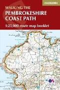
Pembrokeshire Coast Path Map Booklet - 1:25,000 Os Route Mapping

English · Paperback / Softback

New edition in preparation, currently unavailable

Description

Read more


Dennis and Jan Kelsall published their first Cicerone title in 1995 and have since written around 35 guides to some of Britain's most popular walking areas: they have also become regular contributors to various outdoor magazines. Their enjoyment of the countryside extends far beyond a love of fresh air, open spaces and scenery: over the years Dennis and Jan have developed wider interests in the environment, geology and wildlife, as well as an enthusiasm for local history, which so often provides clues to interpreting the landscape.

Summary

Map of the Pembrokeshire Coast Path National Trail, between Amroth and St Dogmaels. This booklet is included with the Cicerone guidebook to the trail, and shows the full route of about 180 miles on OS 1:25,000 maps. The route typically takes 2 weeks to walk, and is suitable for walkers at all levels of experience.

Product details

Authors Dennis Kelsall
Publisher Cicerone Press
 
Languages English
Product format Paperback / Softback
Released 30.04.2016
 
EAN 9781852848965
ISBN 978-1-85284-896-5
No. of pages 80
Subjects Guides > Sport > Other sports disciplines
Travel > Maps, city plans, atlases

England, Walking, Wandern, Trekking, Südwestwales / Southwest Wales, Englische Bücher / Reise / Europa, England / Landkarte, Atlas

Customer reviews

No reviews have been written for this item yet. Write the first review and be helpful to other users when they decide on a purchase.

Write a review

Thumbs up or thumbs down? Write your own review.

For messages to CeDe.ch please use the contact form.

The input fields marked * are obligatory

By submitting this form you agree to our data privacy statement.